Project Introduction:
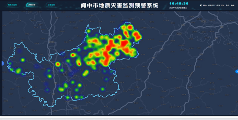
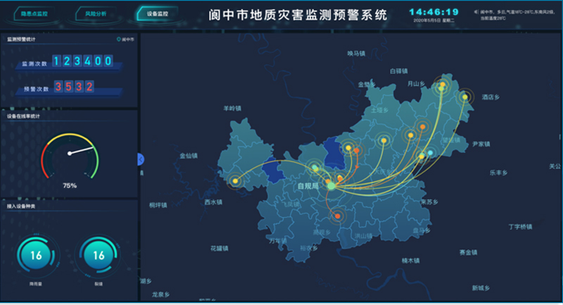
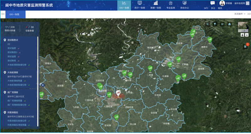
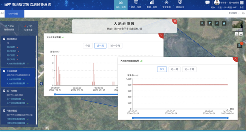
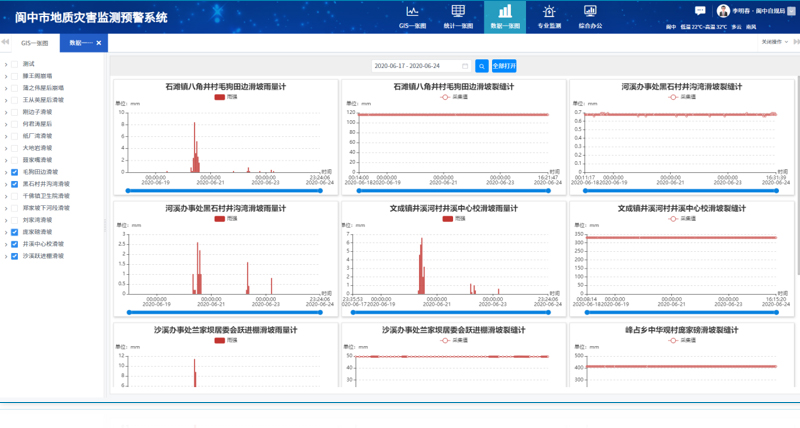
The team has developed a geological disaster prevention and control command platform for district and county levels. This platform includes comprehensive functional modules such as a GIS map, a statistical map (which consolidates information from three dimensions: hazard point distribution, monitoring equipment status, and regional risk), a data map, professional early warnings, and integrated office functions. It has been successfully applied in multiple districts and counties across the country.
Application Areas:
District and county-level geological disaster monitoring and early warning systems.
Technical Advantages:
Data compatibility
Ease of use of functions
Scientific early warning capabilities